Service
A variety of services that we can serve to support your needs
Service
Aerial PhotogrammetryAirbone LIDARGround LiDARAero Magnetics SurveyDronesThopografic SurveyBathymetri SurveyThopografic Survey
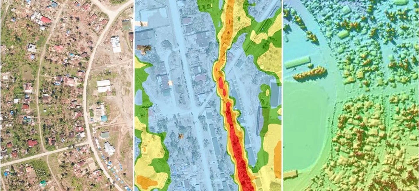
While standard ground surveys are mainly concerned with marking the boundaries of parcels of land, topographic surveys are primarily concerned with noting natural and man-made features on the ground itself. This may include hills, ravines, rivers, trees, fences, buildings, and other improvements regarding the natural state of the soil. Topographic surveys show the location, size, and height of this type of improvement, as well as gradual changes or contours at altitude.
Unlike boundary or occupancy surveys, topographic soil surveys focus more on elevation than on horizontal measurements. Most of these measurements are made with quality survey GPS units, or with electronic EDM instruments. Topographic survey results are drawn as contour lines on land maps (topographic surveys are sometimes called contour surveys). Today, sophisticated computer programs allow the digital version of this map, as well as an interactive elevation view of the ground. engineers or architects can show how topography will change through planned improvements
Unlike boundary or occupancy surveys, topographic soil surveys focus more on elevation than on horizontal measurements. Most of these measurements are made with quality survey GPS units, or with electronic EDM instruments. Topographic survey results are drawn as contour lines on land maps (topographic surveys are sometimes called contour surveys). Today, sophisticated computer programs allow the digital version of this map, as well as an interactive elevation view of the ground. engineers or architects can show how topography will change through planned improvements