Sample
Results from various samples already in the stage of data processing
Sample
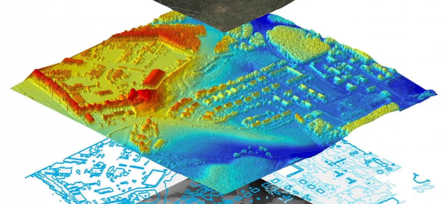
DSM ( Digital Surface Model ) & DTM ( Digital Terrain Model ) Clouds PointPhoto MapContour MapThematic MapDSM ( Digital Surface Model ) & DTM ( Digital Terrain Model )
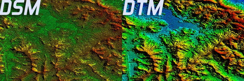
DSM (Digital Surface Model)
or can be interpreted as a model of digital surface. DSM is also an elevation model that displays surface height, if DTM only displays ground (ground surface without anything above it) then DSM displays any existing surface shapes like tree height, buildings and any object on the ground.
DTM (Digital Terrain Model)
digital form of terrain (ground level, excluding objects above) DTM displays more complete data from DEM. DTM is depicted as three representations of terrain surface dimensions consisting of X, Y, Z coordinates stored in digital form which not only include elevation and elevation of other geographical elements and natural features such as rivers, ridge paths etc. DTM effectively DEM has been added with elements such as breaklines and observations other than the original data to correct the artifacts generated by using only the original data. With the increasing use of computers in the engineering and rapid development of three-dimensional computer graphics DTM becomes a powerful tool for a large number of applications on earth and engineering sciences.